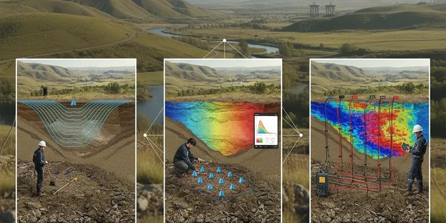
A surprising number of ground investigations in the Swansea area still rely solely on boreholes, missing critical lateral variations in the highly variable glacial deposits and Coal Measures that underlie the city. When a contractor encounters an uncharted buried valley filled with soft estuarine clays—common along the Tawe corridor and near SA1—the programme takes a hit that no amount of trial pitting can predict in advance. Seismic tomography maps these transitions continuously across the site, delivering a 2D or 3D velocity model that ties directly to stiffness and rippability before a single excavation begins. Our field team operates across Swansea, Gower, and the Neath Port Talbot boundary, combining P-wave refraction and S-wave reflection techniques to resolve strata from the near-surface made ground down to competent bedrock at depths exceeding 30 metres where required. For sites where dynamic properties govern the design, the velocity profiles feed directly into a MASW survey to constrain Vs30 for seismic site class, or complement SPT drilling when the brief demands both geophysical coverage and point-test N-values for bearing capacity verification under Eurocode 7.
A single seismic tomography line across a Swansea site replaces six to eight boreholes for bedrock profiling while reducing the risk of missing a buried channel by an order of magnitude.