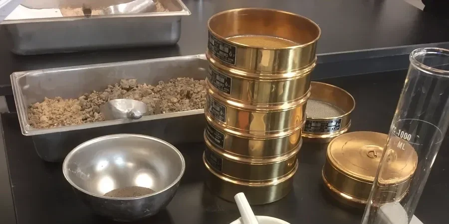
Swansea's geology shifts dramatically within a few miles. Move from the sandstone bedrock and glacial till of the Kilvey Hill area down toward the estuarine clays and silts of the SA1 docklands, and the particle-size distribution tells a completely different story. A clean sand from a borehole near Mumbles Road behaves nothing like the laminated silt we process from a site on the River Tawe floodplain. In our laboratory, the grain size analysis (sieve + hydrometer) is the first quantitative look at that story, separating coarse fractions through a stack of BS sieves and then settling the fines in a hydrometer column. We run this combined method whenever a project needs a full grading curve for engineering classification under BS 5930, or when a contractor has to prove their imported fill meets a tight specification. Triaxial testing later depends on knowing whether the fines content pushes the soil toward contractive or dilative behaviour, and an Atterberg limits determination only makes sense once the clay fraction is quantified.
A full PSD curve from sieve and hydrometer often reveals a silt tail that reclassifies a 'sand' into a silt, changing the drainage design completely.